


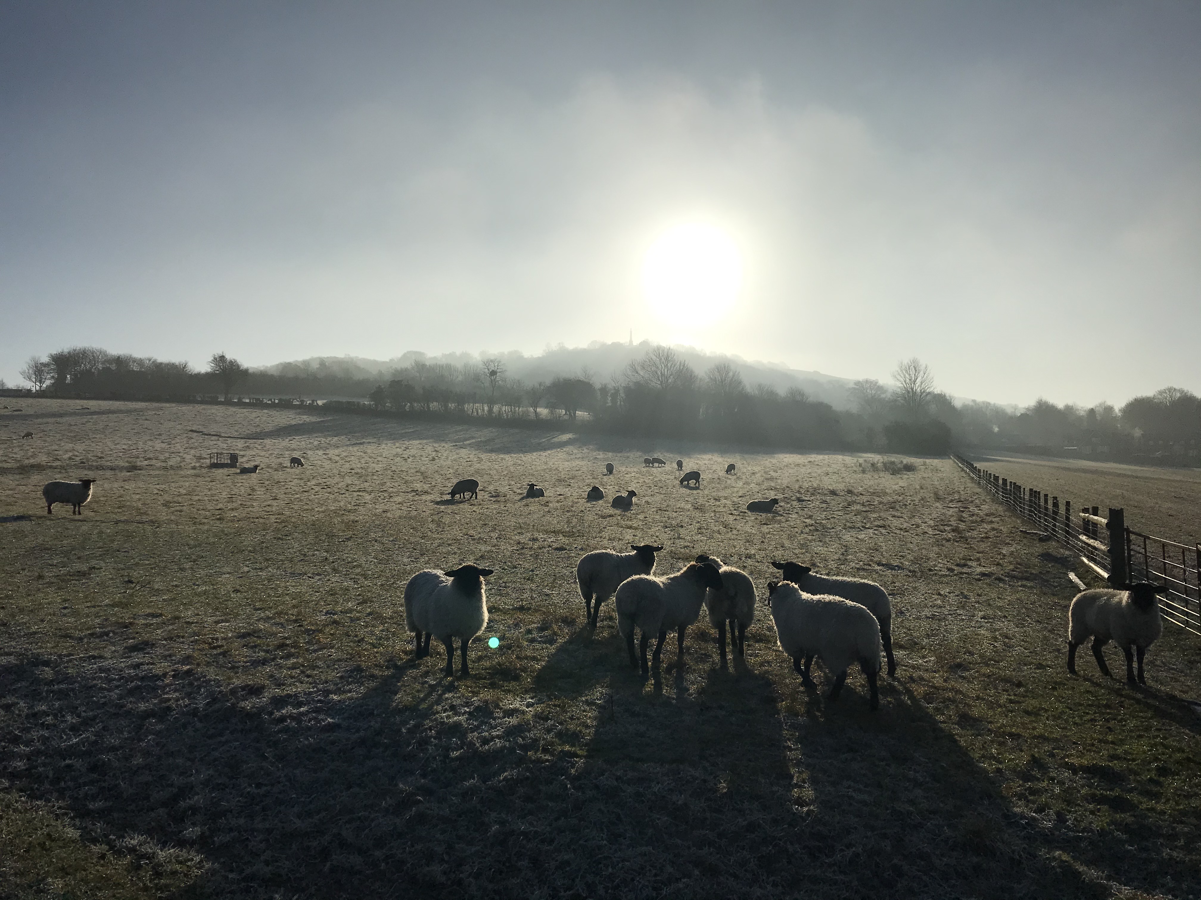
I live in the heart of the British countryside in an Area of Outstanding Natural Beauty, in the south of England at the foot of the Chiltern Hills. This chalk bluff rises from a flat plain and forms an ancient spine stretching across the country from Bath to Norfolk. It was an ancient bye-way, with a footpath used since pre-history called The Ridgeway. The fields around our home contain neolithic workings, roman villas and medieval farm houses, the place names come from old English fused with Latin and Norman and the very hills seem resonant with this rich and powerful history. It’s a special corner of the world to us.
I made this quilt with my children through the summer last year to fasten in time our memories of this little patch of land. The fields and hedges, the rises and falls, the open slopes and hidden paths are the bye-ways of our shared lives, the magic places of my children’s childhood. I wanted to fix them in stitch as my kids grow and inevitable changes creep closer to the edges of this kingdom of quests and picnics.


We love to walk, we tumble out into the fields from the end of our garden and our doggies drag us out everyday, whatever the weather. The familiar fields we walk are beautiful in every season ( if muddy at this time of year). My kids long legs these days see us venture further but with a young family over the years we didn’t tend to roam too far, a couple of hours round walk with tired legs dragging heavy wellies. But these walks are so well known to us all as to be part of us, all the hidden places, the favourite trees to climb, the places to hide, the quiet places where fairies might live, all so familiar. But as my children grow and the landscape changes, this might not always be here. I wanted to capture the memories for the future, the names, the places and the walks.


After creating the fields we transferred this field map to applique shapes and started to pick out fabrics for each field. By this stage it was high summer and the colours we chose were the warm strong colours of sun baked lazy fields.


 As I worked on this project I started to research the history of Map Quilts. I am a quilt historian and I am always keen to understand my quilts in the long history of making in our country. I knew that there were examples of British antique quilts based on maps because the famous Sundial Coverlet from the V&A from 1799 included a fascinating map section and Florence Knapp had made a beautiful modern example of this beautiful map back in 2017 that I was hugely inspired by as I set out on making ours.
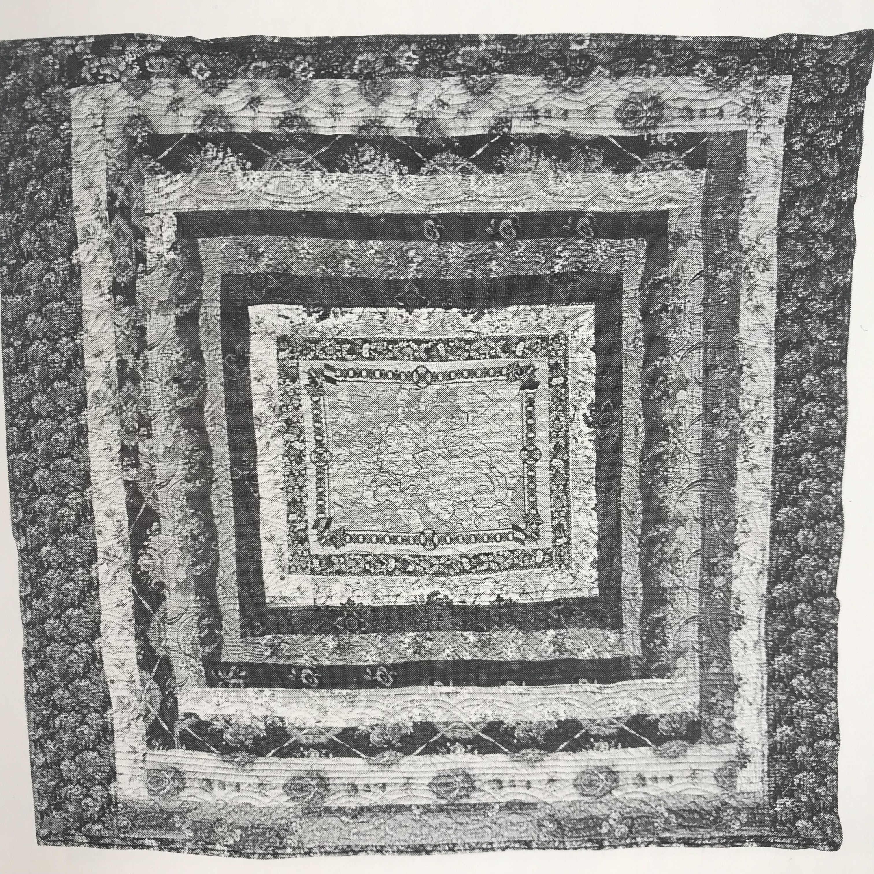
I had made the central panel but needed a way to incorporate this into a finished quilt. I came across this map quilt ( below) in the book Quilt Treasures. Map quilts and embroidered samplers have been found throughout our stitched history as long as maps existed.
This frame quilt, (in private hands and shown at the 1990 Quilters’ Guild National Heritage days) was made after 1914 using a pre printed fabric map panel distributed by the Manchester Guardian published on 7th August 1914 and showing the land campaign of the early days of the First World War.
The map is enclosed in a frame design of heavy furnishing fabrics and hand quilted.
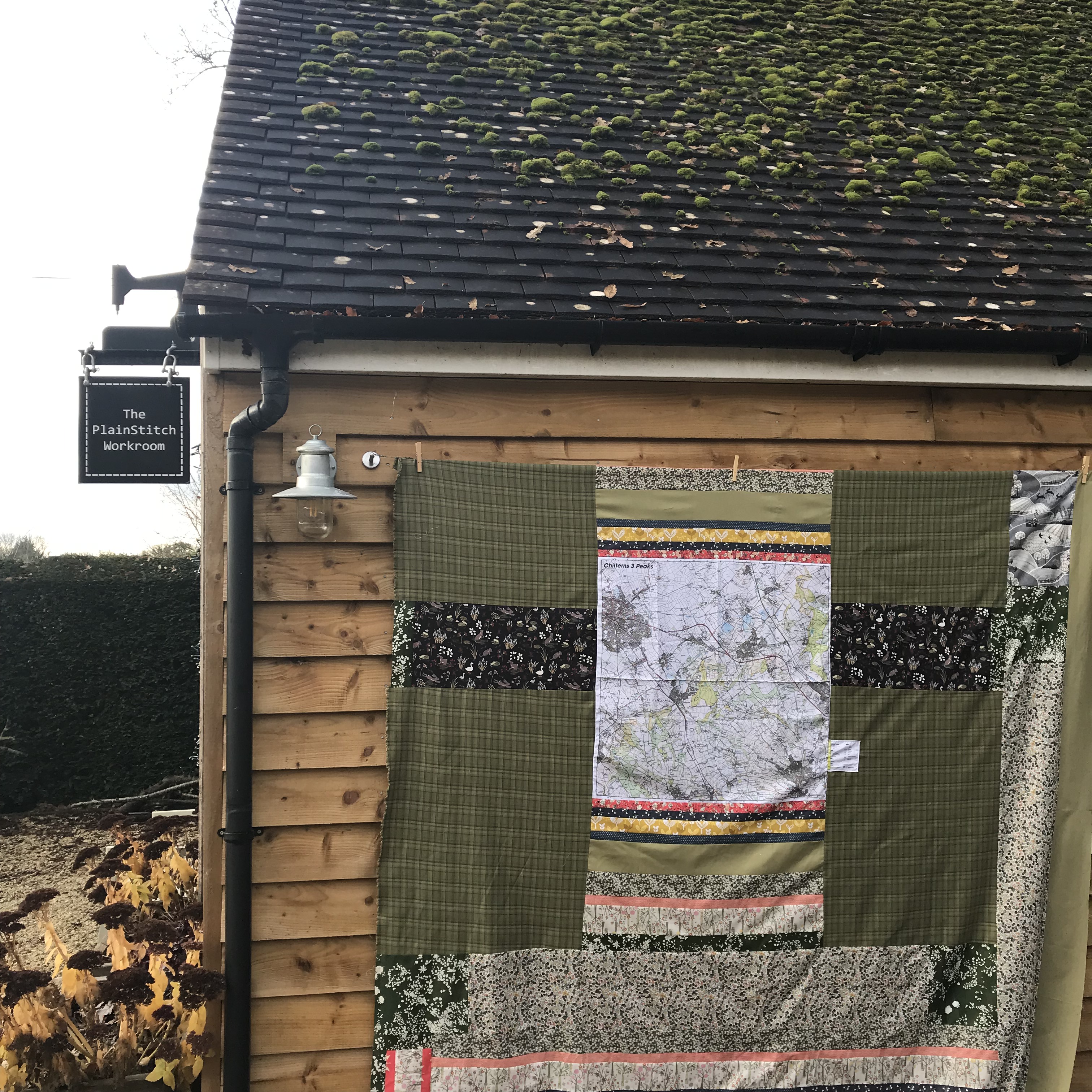
I decided to raid my favourite field-green fabrics and created a frame for my appliqued panel. I used a variety of dress making fabrics, Liberty cottons and Kona solids.
At the time I was making the quilt I was reading a beautiful book that told the story of a famous walk across the fields that I was sewing. In the autumn of 1874 a young, unknown travel writer called Robert Louis Stevenson walked from High Wycombe in Buckinghamshire to Ivinghoe in Hertfordshire. He wrote up his three-day journey across the Chiltern Hills in an essay titled ‘In the Beechwoods’, penned a decade before he found fame as the author of Treasure Island and The Strange Case of Dr Jekyll and Mr Hyde. During his walk, Stevenson observed the natural world, reflecting on the experience of walking across this landscape at a time when England was still largely agrarian and when most people still earned their living from working the land. During his walk he was accompanied by a ‘carolling of larks’ that was so integral to his journey he ‘could have baptised it “The Country of Larks”‘
I loved the poetry of that line and wanted to add it to my quilt, along with other favourite lines and words about place and home from books, maps and poems.

A little obsessed with the idea of fabric maps, I found myself searching the internet for silken maps. The romantic story of the parachute silk maps issued to airmen in the world war is the most famous and I wondered if you could still get antique maps that I could add into my version. Instead I found myself at the other end of modernity having stumbled across a company that make bang-up-to-date fabric maps in waterproof fabrics for bike riders and walkers to replace unwieldy paper maps or unsatisfying digital versions. These maps, made by a company called Splashmaps , can be made to your own personal favourite area, I bought the pre printed Chiltern 3 Peaks Map. This map formed the basis for the back of my quilt and it ended up creating a double-sided quilt, using up all of the scraps that were cut for the front.
I started out by hand quilting the central panel around the fields and marking in the roads in stitch. Then I loaded it on my long-arm and quilted out the rest of the background using a ‘ridge and furrow’ pattern that reflects the texture of the ancient field lines.

The Splashmap quilted up beautifully, it’s silky texture feels super luxurious with the texture that the quilting added – almost silk-like.

After a little windy photo-shoot at the top of the hill this quilt has gone straight into family rotation of kids and dogs on the sofa, it’s light wool wadding with a delicious quilted texture means its fought over at the moment in this dismal cold dark chilly February. The windswept daily dog walker can finger-walk their route in defiant demonstration to the sofa-bound softies left behind as the gales rage.


ps my dogs are quite used to this kind of human-madness, but even they look a little bewildered as we are blown down the hill like a sail on a rare sunny but incredibly windy day this winter!

It has been so interesting reading your very informative post about the how, why and where of your map quilt. Thanks so much for sharing this with us all.
Jenny from New Zealand
LikeLike
Thanks Jenny, I’m glad you enjoyed reading about it 🙂
LikeLike
Deb, it’s beautiful! I love what you’ve done with the frames around the map and the lush earthy colours. Also seeing the beautiful countryside around your home. It’s a totally magical creation – I’m so touched that my map played any part in inspiring it (although I’m sure you will join me in leading many children’s education astray with this!). x
LikeLike
Ha! Thank you, I’m pleased that you like it because I’ve always loved your map exactly for its quirks too – I’m a firm believer in the idea that a map is as much of the imagination as of the land – there was a great exhibition at the Bodleian last year to this end
– beyond here there be dragons!
LikeLike
Also, what an amazing backing!
LikeLike
Beautiful story. Beautiful and heartwarming Quilt.
LikeLike